I guess I have the pig hunting sickness. What started as a fun hobby almost killed me and two friends this past weekend. What sucks is that I’m not deterred. If anything I am more determined to stalk and kill a wild pig on public land.
Several readers have been emailing me asking about my methodology for hunting public land. I’m not worried about training other hunters how to compete with me for wild pigs, but I am surprised anyone is asking. If you’ve been reading my notes it’s clear that first and foremost there just aren’t any ‘public land’ pigs out there and I’m wasting my time, and second, as my buddy Ernie has told me, I’m doing it all wrong.
This hunting story is about how wrong I’m doing it. Maybe after you read this you guys will wisen up and stop asking me where to hunt. It’s clear I don’t know.
I found a 4-mile by 1-mile swath of BLM land up at the Geysers near Castle Rock Springs, CA on my annotated topographic maps. BLM land is legally designated as public land that can be used for hiking and hunting and shooting and camping and general fun-having. While the land is legit for hunting, there’s no guarantee you can get to it. If the public land is ringed by private land, there’s no law or rule saying that the private landowners need to allow access. This swath of land in particular is hard to access because the Geyser thermal power plants sit on the mountain ridges and road access is blocked by heavy-duty fences. The terrain also looked pretty crappy, but at least there appeared to be some access roads crisscrossing the ridges and valleys. It was a long shot, but we decided to go and check it out in person.
New hunters Jason and Mike joined me for this (mis)adventure. My regular hunting buddy Brad was enjoying the huge end-of-season powder dump that Tahoe was blessed with. It was a good thing the late-season winter storm had passed Sonoma County and we were going to be enjoying nice weather! We planned and schemed and prepared for two weeks before pulling the trigger on a Saturday morning. We got a very early start, loaded Jason’s truck to the tits with coolers and hacksaws and guns and gear, and were heading up Pine Flat Road towards what we thought was the trailhead when we saw a big ole motherfucker sign on the side of the road.
“Entering Wildlife Sanctuary; No Trespassing, No Hunting”. The sign was clear, but it didn’t have any logos on it, no California Department of Whatever, no US Department of the Interior. In fact, it was exactly the kind of sign I would put up if I found a huge wild pig population on public land. You know, to deter other hunters. We pretended we didn’t see the sign and continued on. The second sign was similar looking, but stated simply “No Trespassing, No Hunting”. Both signs were on private property and they were probably just warning hunters off that specific land.
The third sign was a doozy. We stopped, read and re-read it, and looked at each other glumly. “Macaymas Mountain Sanctuary; managed by the National Audubon Society; No hunting, no shooting, no trespassing, no having fun, on pain of death, Sonoma County Sheriff, blah blah blah”. God damn it! We had now been driving for more than an hour, we’d been up since 4AM, and Jason’s truck was starting to smell suspiciously like eau de ass (Mike has a flatulence problem; sorry Mike, I swore I wouldn’t tell but it’s important to the story).
We rolled down the windows, vented the cabin a little, and conferred. I was SURE the land at the top was BLM land. My maps didn’t show any BLM land where we were, but they also didn’t show anything about a Mountain Sanctuary. Was it possible the BLM land was somehow designated as non-hunting land? Sure, I guess, but I had searched and didn’t find any prohibitions against hunting at the Geysers. Aww man, what to do, what to do?! We didn’t want to poach, we didn’t want to be those bad hunters that everyone hates.
It turns out the Autubon Society was gifted some 1400 acres of land in the middle of Pine Flat Road, right where the signs were. I guess it makes sense that they would have signs up, but geez, it would be nice if they would demarcate their sanctuary boundaries a little better.
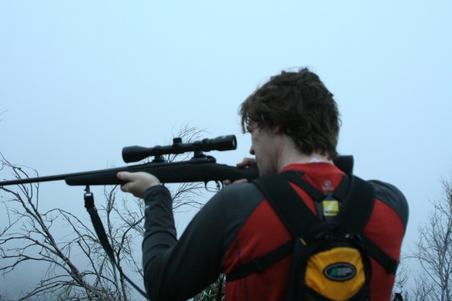
We continued up the mountain, surprised a jackrabbit in the truck headlights, found the trailhead, parked, double-checked the maps and GPS, and prepped for our hunt. The stars were beautiful as we were quite far away from other lights at almost 3000ft. It was bone-chillingly cold, but at least it would warm up after sunrise. We found the right trail and headed off into the darkness.
Half an hour later we saw the wobbling lights of a car or truck heading up the same road we came in on. It was a little surprising to see anyone else out at this stupid time of the morning and we figured it was the local vandals coming to break into Jason’s truck and steal whatever gear we had left behind. Faced with the prospect of a half-hour uphill hike back to the truck, we decided that there wasn’t much we could do anyway, and we hoped they would just break the windows and steal our stuff rather than slash the tires or burn it to the ground.
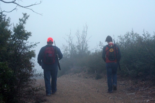
What started as a cold and clear night quickly became less clear as we walked into heavy fog. No problem, it would burn off in an hour when the sun came up. We soldiered on, keeping moving to stay warm. An hour into our hike the sky was starting to lighten up but the fog was so thick we couldn’t see anything. We heard this eerie crackling and tearing noise high above us. It was an incredible noise, caused by the huge amounts of electricity carried by the power line towers.
We followed the hard-packed access trail and came upon a small mud puddle. No wallow signs, but then again it was cold enough that the pigs probably wouldn’t want to wallow. It was really cold! After some close investigation we discovered what looked like a pig footprint. Woohoo! Now this was a big deal. Where there are pig footprints, there MUST be pigs. It was strange that there was only one footprint, but we’re not going to second guess leaping pigs who manage to only leave one hoof mark in passing.
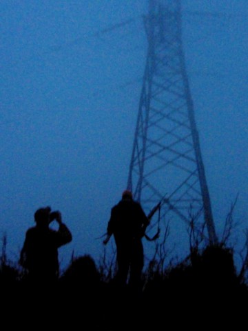
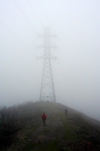
Based on prior examination of the satellite photos, we turned and followed a smaller trail leading to this huge table-top plateau with a monster power line tower at the end. These towers were so huge and unexpected in the otherwise barren wilderness it was a little surreal. The tower was an anchor point for a span of power line that crossed a ravine. In a moment I will refer to as The Point of Poor Decision Making, we headed down into the ravine.
We had been hiking now for more than an hour. We weren’t thinking about how we would get the pig back to the truck, we were just trying to keep moving to stay warm. The sun had supposedly risen, but there was no evidence of this from our cold and wet perspective under the power lines. I’m not sure what the thought process was that took us off our nice comfortable trail and into the thick underbrush, and I can’t figure out why we would head downhill with such determination, but that’s what we did.
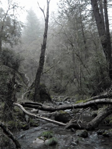
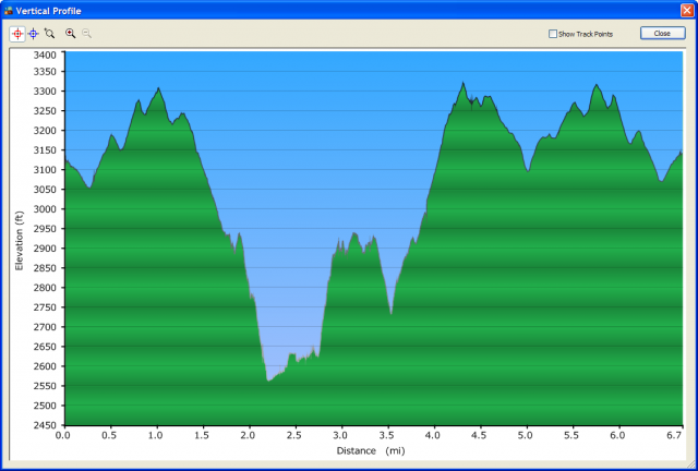
We descended 400ft in a quarter mile and saw no pigs. We saw no wildlife at all. In fact our visibility was getting worse due to the thickening fog. We pressed onwards (why oh why didn’t we go back?!) and came to the only redeeming aspect of our day: a scenic and beautiful stream running along the bottom of the ravine. The burbling water and untouched nature was special. I took a moment to pause and let it sink in.
The scene was also special for Mike and Jason, both of whom slipped off moss-covered rocks into the zero-degree water with their non-waterproof shoes. Yes, they let it sink in too.
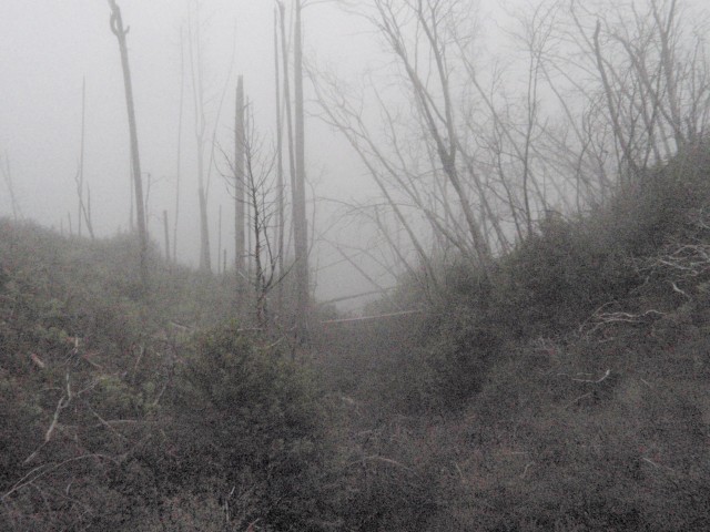
Ok, this next part sucked and there’s no way to sugarcoat it. We followed the river for another half mile before we simply could not continue. The underbrush was so thick that forward passage was impossible. I think the fog was coalescing into a low-lying storm cloud, but at least it wasn’t raining! We were now far enough from the Point of Poor Decision Making that backtracking was untenable, but we also didn’t really know where we were on the map (ie: we were lost) and so we couldn’t figure out where to go instead.
Jason’s iPhone became our lifeline at about this point. It turns out that he was able to connect to the awesome life-saving Edge network (thank you, Edge network) and we were able to download a satellite map with our location superimposed on it. Oh mother of everything that is good and holy thank you for the iPhone, savior of lost souls, rescuer of stupid pig hunters.
We found a sweet-looking jeep trail just a mile to our east that would take us in a roundabout way back to the hard pack trail we started on. We just needed to hike back up a 400-ft hill, which unfortunately wasn’t 400ft of elevation gain spread over a quarter mile, it was 400ft of elevation gain in about 400ft. During this difficult and seriously demoralizing climb it started to rain.
Jason was the best dressed of the three of us. He was wearing three long-sleeve layers. Mike had a long-sleeve fleece on. I was wearing a lightweight long-sleeve moisture-wicking shirt and a t-shirt underneath. Jason and I were wearing jeans, Mike had some thinner ‘tactical pant’. I guess the important part to focus on is how none of us was wearing a jacket or was carrying anything even remotely waterproof. We were wet.
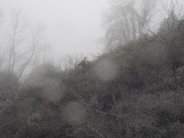
The mile-long trek to the jeep trail was epic. After the monster hill we waded into a forest of chest-deep sagebrush. Each plant was now totally waterlogged, so as we would push our way between them all of the moisture on the leaves would be directly transferred to our now-soaking clothing. Forward motion slowed to a GPS-confirmed pace of half a mile per hour. Frustration levels rose until at one point I was getting ready to shoot the next fucking sagebrush plant that had grown intertwined with a neighbour.
Every half hour we would reconvene and look at the iPhone map. We were getting a small tiny little smidgen closer to the jeep trail. It was now fully raining and we were completely soaked. Humour had left us and as an indicator of how thoroughly depressed we had become, we unchambered our rifles and decided that we would probably not shoot a pig if we happened across one. To be honest, we were starting to become a little unsure about our ability to get back to the truck, let alone us plus a pig.
The rolling terrain was challenging, we were never walking on flat ground. The wet, cold, and slippery conditions were challenging, every log was a skateboard accident waiting to happen. The brush was challenging, sometimes we simply could not walk in a certain direction, we would need to double back and try another way. Yes, there were Gandalf-like sagebrush plants sticking their little sagebrush staffs into the ground and declaring with great force and determination “You Shall Not Pass”.
Jason was pushing his way through some brush when he tripped and fell. He collapsed into the brush. The brush held him up at a 60-degree angle. Jason’s not a small dude. That brush is fierce stuff. We agreed that if we made it out alive we were going to donate money to some nonprofit group that sets fire to sagebrush. Not because we want to make passage easier or anything like that, but because we wanted the brush to burn.
We eventually made it to the jeep trail. Ahhh, we were saved. Our spirits rose, we sang a little, and we joked about how easy the brush had been. Jason had cut his hand pretty badly so I opened up the first aid kit and swabbed it with an antibiotic pad. There was a lot of dirt in the cut and I needed to scrub it pretty hard, but even with all the alcohol he didn’t seem to mind. I thought he was a real tough guy, but he confessed that his hands were completely numb from the cold and he couldn’t feel anything.
My waterproof boots, totally awesome earlier in the day, had been acting as reservoirs for the runoff streaming down my jeans as we fought the undergrowth. At least Mike and Jason’s non-waterproof shoes were venting the water they collected – they squished with each footstep. My boots held the water and it was sloshing back and forth with every step. Like a mini spa for my feet.
The first few hundred yards of the jeep trail were really nice. It was a little overgrown, sure there were 5-foot trees in the middle of the path, but the trail was sorta kinda visible and it was slightly easier than pushing through the sagebrush. We headed downhill again and came to another stream crossing. This time Mike and Jason managed to get across cleanly. I was punished for laughing at them earlier with a small slip and a bit fat soaker.
The jeep trail was deteriorating. Well, maybe deteriorating is a bad word choice because it implies that the trail was good at one point. The jeep trail was never good, it just was a tiny bit easier than pushing through sagebrush. It was totally overgrown and after we crossed the huge stream that had totally cut through the trail, we came across our first fallen trees.
We consulted with the iPhone, the holy bringer of truth and satellite vision. Jason has a picture of Jenean and Caden setup as the swipe-screen image. Every time we would gather around and try to shield the phone from the rain Jason would say “that’s a warm-looking baby”. I was incredibly envious of this photo, truly a picture of hope. It seemed to give Jason strength and give him something to work towards, whereas I would just see the progress we hadn’t made and get more and more depressed.
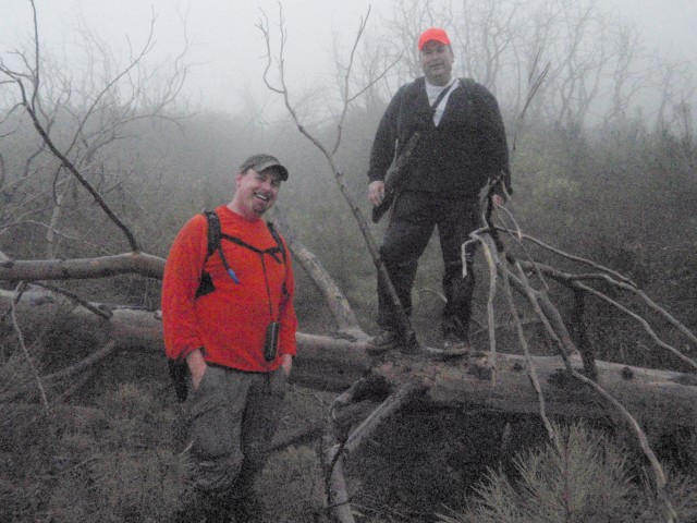
We were on the jeep trail. The satellite photo showed a nice clear trail. Reality did not match. The trail had once been a nice clear trail, I’m sure, but it was now completely overgrown and neatly bisected by fallen trees. I don’t know how or why the trees fell the way they did, but every 100ft a tree had fallen directly across the trail. Perfectly perpendicular. All of the fallen trees were at the same chest-level height.
Getting around a fallen tree sounds like it might be easy, but it’s not when you’re on a jeep trail. You can crawl under it or climb over it. There is no going around, we tried. The sagebrush was lurking at the side of the trail. Each tree is covered with clothing-grabbing branches and sharp stubs. Each tree was a separate challenge. We climbed over and crawled under trees for another hour. During this time the small spark of hope was completely extinguished.
The iPhone showed that the jeep trail met a slightly larger trail, but we weren’t sure if the larger trail (which looked like the trail we came in on) was going to be a real trail or another nightmare tree-covered trail. We dared not hope. Based on the stupid jeep trail we had now been heading further south. Jason’s truck was north. I don’t know if we were thinking clearly at the time, but I can hazard a guess that we were probably not.
We finally arrived at the main trail. It was a real trail. We were cold, wet and tired. We were happy, but we knew there would be another challenge for us to face. We weren’t sure what it was, but the evil Geysers wouldn’t let us escape so easily. No one hunts the Geysers. The Geysers do not like to be hunted.
The last test of our fortitude turned out to be the cold. The real trail is a ridgeline trail. It runs neatly along the top of the ridge, 2.5 miles back to the truck. Of course the wind was blowing pretty hard and the thick foggy cloud of moisture was whipping across the trail at 30mph. We were totally soaked, and so the wind cut to the bone.
I was in worst shape: my wicking shirts were transparent to the wind and I was shivering hard. I know that shivering is bad, but you will only shiver for so long before you deplete your energy stores, you stop shivering, and hypothermia sets in. I knew I was running low on energy, we had been hiking for five hours and I hadn’t eaten anything. I kept the pace pretty quick and thankfully Mike had been hoarding some crackers, but the push back to the truck was a little scary. Thank goodness the early-morning vandals hadn’t been vandals, I don’t think we would have been able to deal with slashed tires or broken windows.
We hiked 6.7 miles in 6 hours. We covered 1500ft of elevation. We saw three animals all day: the jackrabbit in the headlights of the truck in the morning, and two little lizards on the jeep trail. Jason claims to have seen a squirrel, but he may have been hallucinating. We saw one pig footprint, which we all agree was probably something else.
This has been our most unsuccessful hunt to date and we are all thoroughly depressed. Depressed, but not deterred. I will kill a pig on public land!

11 Responses to Doing it wrong: hunting wild pigs at the Geysers